North Carolina, Mapped

Culture maps of North Carolina

How North Carolinians live, talk and argue, mapped across the state’s 100 counties.
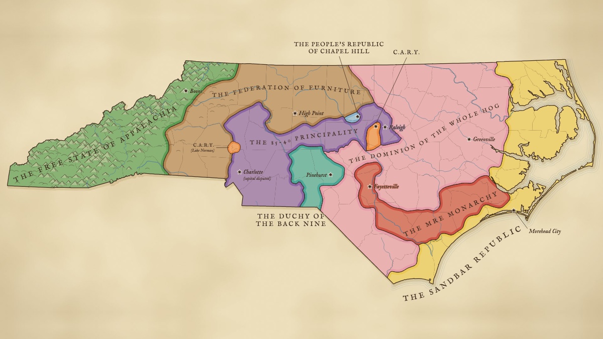
Old-atlas style map of North Carolina divided into nine invented nations, among them the Free State of Appalachia in the mountains, the 85-40 Principality from Charlotte to Raleigh, the Whole Hog Dominion in the east and the Sandbar Republic on the coast.132k views on X
Culture · Oct 24, 2026

The Partition of North Carolina

North Carolina has fallen. Choose your faction.
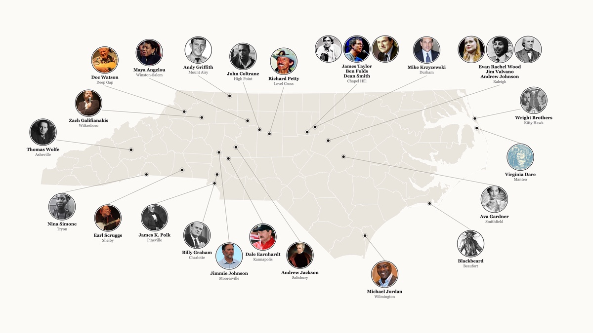
Map of North Carolina ringed by circular portraits of 26 famous North Carolinians, from Michael Jordan and Maya Angelou to the Wright Brothers and Blackbeard, each linked by a thin line to the town where their influence happened.188k views on X
Culture · Oct 10, 2026

North Carolina’s Cultural Titans

From first birth to first flight, the people who made North Carolina.
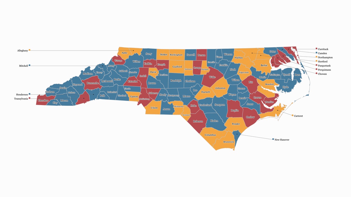
Map of all 100 North Carolina counties, each labeled and colored blue for yes, gold for let’s think about it, or red for no, according to whether the county’s name would work as a baby name.74k views on X
Culture · Sept 19, 2026

Can You Name Your Baby After an NC County?

All 100 North Carolina counties, ranked: yes, let’s think about it, or for the love of bbq and grits, no!