North Carolina, Mapped

Geography maps of North Carolina

North Carolina’s land, weather and seasons, from the first freeze to the length of the day.
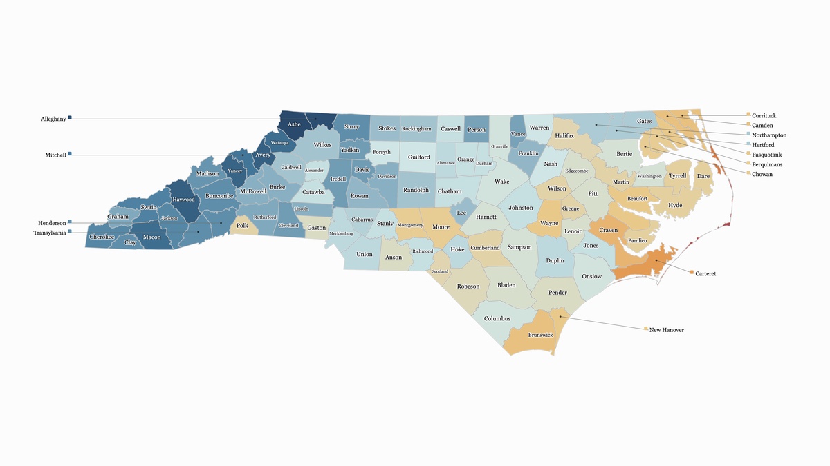
Map of North Carolina’s 100 counties colored by the typical date of the first fall freeze, on a scale from dark blue in early Oct to red in late Dec. The mountain counties are darkest, Ashe and Alleghany first around Oct 10; the Piedmont is pale, around the first week of Nov; the counties along the sounds and Carteret turn gold and orange in mid to late Nov; the Outer Banks are a thin red strip, freezing last in Dec.
Geography · Nov 7, 2026

When Does Your County Get Its First Freeze?

The typical date of the first 32° night of fall in every county, from the mountains in early Oct to the Outer Banks in late Dec
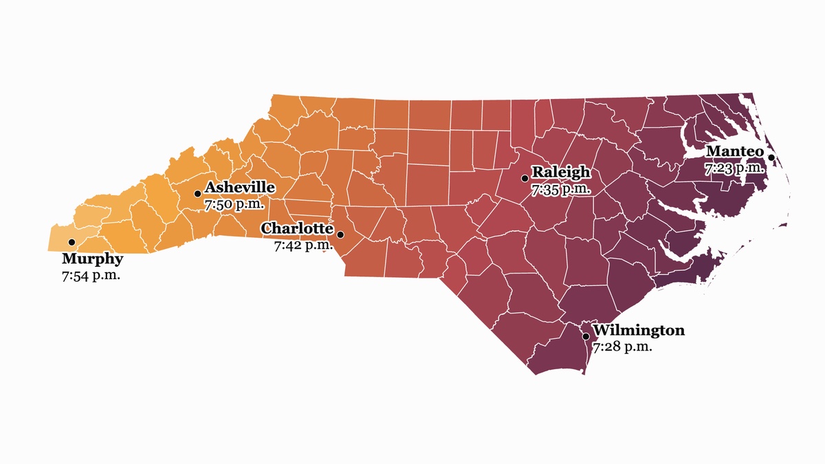
Two maps of North Carolina’s counties. The top one, in blues, shows the latest sunrise of the year if the clock stayed on daylight saving time: after 8 a.m. in every county, from 8:14 a.m. in Manteo to 8:45 a.m. in Murphy, darkest in the mountains. The bottom one, in gold, red and plum, shows the latest sunset of the year if the clock stayed on standard time: before 8 p.m. in every county, from 7:23 p.m. in Manteo to 7:54 p.m. in Murphy, darkest on the coast.Interactive40k views on X
Geography · Nov 1, 2026

Lock the Clock, and Something Has to Give

Sunrise and sunset in every county, any day of the year, under today’s clock, permanent standard time or permanent daylight saving time